Looking for a very old man...

More exploring! One would think we’re amateur archaeologists what with our interest in the various digs around this northern region. Having visited the Bujang Valley and seen digs dating back 1000 years, we thought we’d have a look at Lenggong where the remains of Perak Man were found.
The oldest human remains found in the Peninsula, Perak Man dates back about 11,000 years and is usually displayed at the Lenggong Archaeological Museum & Gallery. I’d wanted to come by when Mei, the kids and I made a trip to Belum a few years ago, but we were in a rush to get back to KL and skipped the visit. Time now to fill in that gap and meet the man…
As we have done a few times now, we set off from Penang and went across the second bridge and onto the North-South before exiting at Bagan Serai and then onto the A6 which makes a slight northern loop before coming back south past Lenggong as Route 76.

 |
| Maps are screen captures from Google Maps |

This part of Perak has many quiet, well-paved roads and we could cruise at a very slow 65-70, a speed that allowed us to have a better look at the kampungs we went through and the road signs that sometimes pointed out interesting spots.
Along this route you might see large brown signboards listing multiple places of interest, the majority of which are waterfalls. We spied one called Lata Buluh and also had our curiosity piqued by two other names: Telaga Gergasi and the very oddly named Sungai Atas Sungai.
Bamboo Waterfall and a nice old man, but not THE old man.
To get to Lata Buluh (Bamboo Waterfall) you have to get off the A6 at Kampung Ayer Jerneh and drive up a very narrow but well-surfaced kampung road. The road runs beside a river for the most part then shortly after you see a small dam, it takes a left across a narrow metal bridge before climbing right past a few houses. A short distance later the road ends in a small cleared area beside a house and this is where we parked to explore. The owner smiled his agreement when I asked if we could park there and we then wandered down to have a look. A nice enough spot for a picnic actually, though this wasn’t our intention.A low waterfall that was more a series of rapids than anything else, this area had quite a few pools that probably lent themselves well to wading and splashing about. Lots of rocks, not too much rubbish though enough to indicate that it was a reasonably popular spot.


 |
| Lovely curls in the roots |

 |
| We walked up a short distance then decided not to carry on. Would it go to the top of the falls? Maybe we'll find out on our next visit. |

We didn’t go up very far and it seemed to deviate a little from the path of the rapids so we walked back down and headed back to the car. The area itself is quite pretty and would make a nice spot to have a picnic, though there aren’t many clearings to set a mat down.
I looked out for the gentleman who had let us park in his garden, to thank him, but found that he was instead looking out for us, to tell us that if we went up the hill past the carpark, the waterfall was even more impressive.
And so we drove up the 100 metres or so to a place where we could park and walk down. Impressive indeed!


Much higher than the low rapids we’d seen, this was a good 2 or 3 stories high, the water crashing down over a rock face and into a large pool in which a family were splashing about. The water ran off to the right, down to the rapids we’d been at earlier.
On this side of the bank was a small clearing where people have set campfires and so on. A few large rocks gave a clean surface to rest or place one’s belongings, as this family had done. The clearing itself was just bare earth and grass and I cast a wary eye out for leeches…
The Old Man hides from us
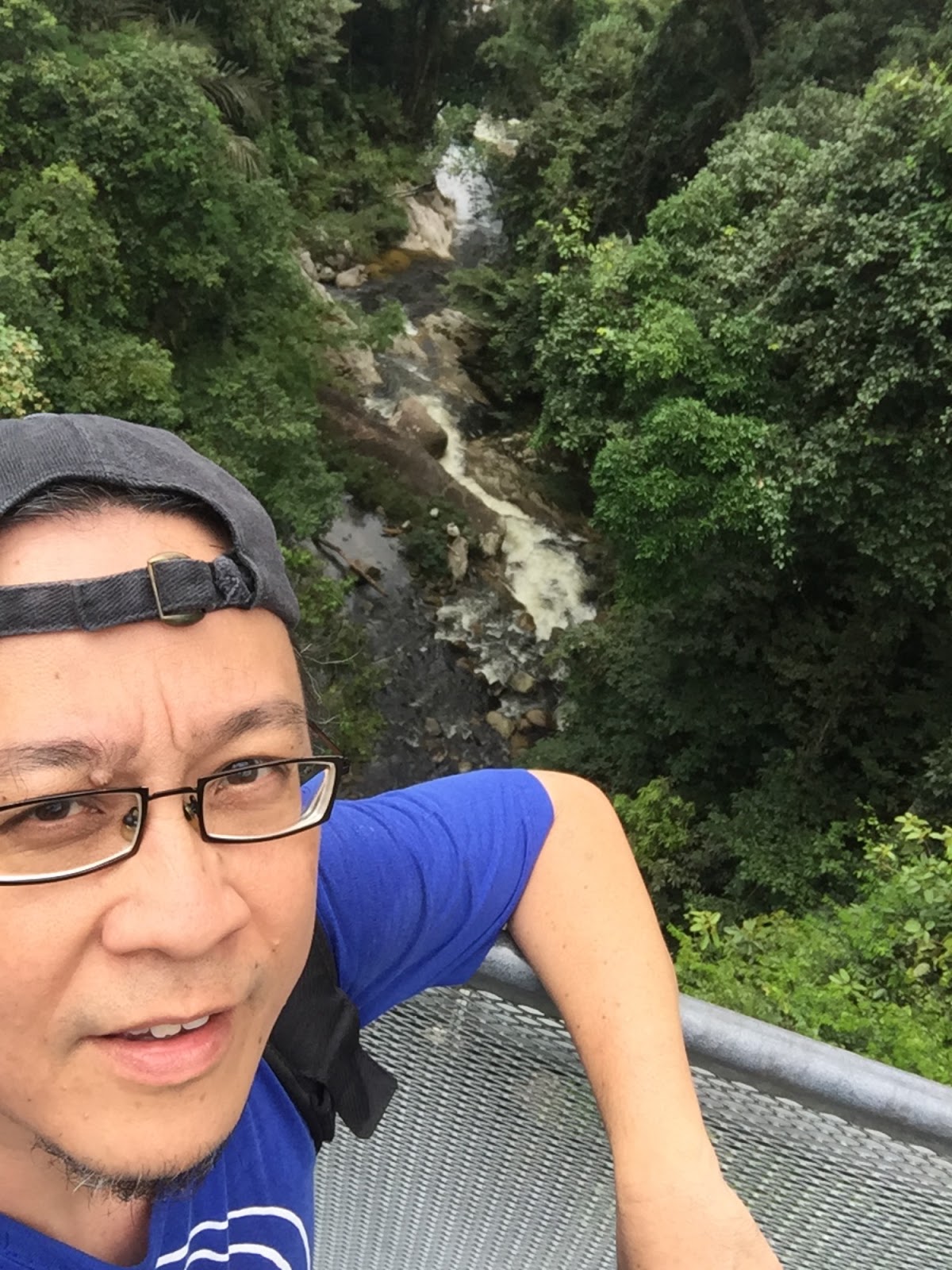
On the A6 and heading northwards, we crossed a few bridges, one of which had been laid across a gorge. To the left of the road was a tall, meandering waterfall, the water cascading down a hundred or more feet of foliage-fringed rockface, disappearing beneath the bridge and then continuing on the right, as a much quieted river weaving through a verdant countryside. Quite pretty.


The A6 makes a curve southwards whereupon we turn onto Route 76 and continued south, going through Lenggong town. We had no difficulty locating the Lenggong Archaelogical Museum a little distance away. It is well sign-posted with even a big stone sign on the main road. The road in is also well paved and the building looks brand spanking new. But the gate was shut…
The guard at the guard house told me the museum is being renovated.
‘When will it open again?’ I asked.
‘Don’t know’
‘So where are the exhibits and all that now?’
‘Don’t know. But I think there’s a temporary gallery.’
‘Where is that?’
‘Don’t know…’
I could see this was going nowhere so we headed off, leaving Mr Don’t Know to his work. It seemed a shame as the museum building looked quite ready, from the outside. It had been painted and was actually quite stylish. So, after all these years, it seems I was still to be denied my introduction to Perak Man.
Back on the main road, we turned left and headed south. And what do you know… a short distance down the road we spied a small signboard, stuck in the ground, and pointing right to ‘Temporary Gallery’… Further up were a couple of right turns and we took the second one which led us through a large Chinese village only to come back to the main road a the first right turn. Maybe we’d missed it, so we went around again. Nothing.
On our third pass, locals were beginning to stare at us… and, nothing. We could find no building or structure that could have been a temporary gallery for Perak Man. This old guy was proving to be very elusive indeed!
We headed back north towards the gallery, keeping an eye out for maybe a small road that we’d missed. Just a little south of the small signboard was a turning on the left side of the road and it led to a bungalow about 200 metres in. Frustrated after a number of loops, we decided to drive in and ask if anyone knew of the temporary gallery.
Quite a modern single storey bungalow, there was a small guard house clad in corrugated plastic sheeting and in the porch was a sofa set and a desk manned by a guard. Out front were the 3 flagpoles denoting a government or official function. We stopped and I wandered over to the guard to ask him.
‘Hi, sorry but we were at the Archaelogical Gallery and the guard there said it’s closed for renovations, and there’s a temporary one which he didn’t know the location of. On the road though, we saw a sign but can’t find it. I wonder if you know where it is?’
‘Yes,’ he said. ‘This is it…
Turns out a left arrow had been pasted over a right arrow on the signboard but had fallen off…
And so we spent the next hour in this small and rudimentary home to a replica of Perak Man. So we still have not actually met, as it turns out…
There were a few young archaeologists preparing for an official visit the next day but one of them took time off arranging display boards and so on, to explain a few things to us.
We finally meet. But it's not really him
Through him we realised the skeleton on display was really a replica and that the original would be in the gallery when it reopened. He also explained that Perak Man was unusual as he was around 45 years of age when he died, almost double the normal life expectancy pf the time. He was also deformed and that, together with the fact he was buried with a lot of tools and decoration - shells and so on - indicated that he had special social standing and was probably a shaman or something similar.The remains were actually found in a cave, Gua Gunung Runtuh, in a limestone massif called Bukit Kepala Gajah, a little distance away. Lenggong itself is the site of the oldest known human activity in the Peninsula with prehistoric stone tool workshops dating back 74,000 years. Other sites in the area have stone tools dating back 100,000 years!
 |
| Picture of the new Gallery as taken from Google Streetview |
 |
| Replica of Perak Man |
 |
| Various stone tools |
 |
| An Axe Head can be seen on the top right corner of this chunk of stone |
The temporary gallery is hardly visited by the public (perhaps the sign has something to do with it… Having said that I am looking forward to dropping by the gallery when it is open again, which they told me is scheduled for the new year.
I hope then to finally meet the Old Man in person.
A Double-storey River?
Back out on the road again, we headed north, retracing our steps and when we once again saw the signs for Sungai Atas Sungai and Telaga Gergasi, we swung off the main road and went down a very narrow kampung road. On one side was a canal and on the left were a few kampung houses. A few hundred metres in, the road curved left and then ended at a concrete structure that looked like a bridge but rather smaller.The bridge was of concrete and had an arch on either side, giving the impression it was a suspension bridge which it clearly was not. Beneath the bridge ran a river, its brown waters running between two heavily foliaged banks.
The bridge span was also of concrete and wide enough for a car though a sign on the left proclaimed it not to be designed for vehicular traffic and anyone attempting to traverse it by vehicle was doing so at his own risk. Strangely, along the length of the span, set in the middle of the concrete surface was metal grating, painted blue to match the concrete arches. A canal ran right up to the concrete span, perpendicular to the river beneath.
And then it struck us! This is why it’s called Sungai Atas Sungai - the canal continued WITHIN the span, running merrily along under the blue grating, to emerge on the other end and continue on its way above ground. Here really, was a river above a river!


The sign, in very poor English, but better Malay, detailed that this irrigation structure was built by the British in 1936 to irrigate padi fields as well as to run stream water through the Telaga Gergasi 5km away.
I’m writing this a few weeks after our drive, and am still amazed at how this structure was even conceived and executed. Surely one of the stranger feats of engineering I’ve ever seen.
Well, well, well
To get out we had to reverse the car onto the bridge and it held. Good - I would have been very embarrassed to have effected the destruction of a very quirky piece of engineering.Across the main road and a few kilometres up a narrow gravel road running alongside the canal, we found an even stranger sight. Telaga Gergasi or Ogre’s Well. The canal ended abruptly in a fenced-off circular metal structure, water pouring down the throat of this well in a continuous thunder. The bottom of the well could not be seen and I had no wish to sneak around the fence to have a peek.


A sign said the well was 100 feet deep though I suspect it is a bit shallower. The water went down this structure then spilled over a lip below to run off down to the river behind us and maybe about 2 storeys lower down. A set of concrete steps could be seen, heading towards the river, but we didn’t explore that.
Presumably the lip allowed heavier tin deposits to lie trapped at the bottom of the well and this is apparently its purpose - a sort of automatic tin dredge. Very clever indeed!
This was built at the same time as Sungai Atas Sungai, and I can’t help but wonder at the imagination and cleverness of the engineers back then. They certainly had created two very quirky, clever and innovative solutions to some basic problems.
Very clever, these British fellas…
Lata Buluh is here: 5°7'45"N 100°52'34"E
Telaga Gergasi is here: 5°6'12"N 100°45'26"E
Sungai Atas Sungai is here: 5°7'9"N 100°46'27"E
You can read more about Perak Man here:
https://www.thestar.com.my/data/archives/2013/07/04/16/20/perak-mans-bones-tell-his-story/