Tuesday 19 May 2020

They called me John ‘Two-Hits-With-One-Stone’ Cheong


An old memory came to me today when Mei and I went cycling in Balik Pulau. After 2 months of being cooped up in our flat, it was great to be once again in that semi-rural part of Penang, cycling past padi fields, rivers and swathes of mangrove, breathing in unpolluted air as the birds swooped around us and the hills framed our view in verdant green.
We’d done a very short ride, easing our long-idle muscles back into cyclic effort. After just under 6 kilometres, we returned to where we’d parked and began to pack the bikes back into the back of the car. 

We were in the shade of a few large trees, in a little clearing where a lady usually runs a small drinks stall. The roofless structure from whence she dispensed coconut water and canned drinks belied her true standing in the area - in fact she was the owner of the 14 acres of padi fields on either side of the lane that ran past this little stall. She had horses which she said she had no time to take care of so she had a friend care for them. And every year or so the stall would become deserted when she took off to spend 3-4 months with her family in Australia.

Today the stall was indeed deserted. The Movement Control Order had probably forced its closure. The clearing, though, was a convenient place to park.


On one side of the road, the fields had been planted with fresh padi and a number of workers were busy spraying pesticide. On the other side of the road was Sungai Burung, a narrow canal that lent its name to this area, then more fields. These had not yet been sowed but would soon be, if the tractors churning up the soil in the distance were any indication.

Opening the boot of the car, I spied one of my catapults tucked into a side pocket. I have two - the other lies disassembled at home. An effort to use car inner tubes had failed. Modern tubes are of a synthetic material that does not have the elasticity of rubber.

This catapult, though, was bought complete with sturdy square-section rubber lengths that seemed to do the trick. On an impulse, I took it out and looking down, realised there was gravel aplenty beneath our feet. Picked up a roundish stone, stood on the edge of the road to have a go. Mei wandered over to have a look. I pointed to a piece of wood floating along with the current, took aim, and smacked it loud and hard with a perfect shot.
“Wah…’ said Mei.

…….

Late 70s. Port Dickson. I must have been 13 or 14. We were on holiday with some of our extended family including my good buddy in those days, my cousin Winston, who is a year younger. That seaside town was a favourite school-holiday destination for our families when we were young. The waters were clear then, and the beaches clean. We snorkelled, fished, built sand castles or wandered around picking up shells. We got sunburnt and we gathered memories to last years.

Both Winston and I were pretty good shots with our home-made catapults. The ammunition we used were flung hard and fast when the wound-up force of stretched lorry-inner-tubes was released. 

These tubes were carefully cut to a consistent width and length, bound by rubber bands to a leather pouch on one end and the smooth wooden Y of the catapult on the other. When newly assembled, the rubber required great strength to stretch but with repeated pulls they became more pliant. 

Winston and I were walking along the beach, picking up rounded pebbles and letting fly at all sorts of targets. For some reason our aim that day had been less than perfect. Unbeknownst to us though, our peregrinations had attracted the attention of some kampung boys who were trailing us, each also armed with a catapult. 

Winston and I chatted as we walked, and shot at things rather aimlessly. At one point, I spied the empty shell of a small crab just a few feet from me. I took aim and let fly, only to see my stone bury itself in the sand 6 inches from its target.
As I chastised myself quietly ‘useless…’ a stone whizzed past me at knee height. It smacked right into the crab shell I’d just missed.

Winston and I whirled around and that was the first we saw of the kampung boys, 3 or 4 of them, roughly our age or younger. They wandered over and silently issued a challenge by picking up a stone and placing it on a small rocky outcropping on the edge of the water about 15 feet away. 

Still wordlessly we accepted the challenge. Winston went first, his pebble missing by a foot or so. The boys went in turn and all missed, some by not very much. My turn came…

I missed.

Then I looked down and at my feet was a discarded packet drink carton. To this day I have no idea why I picked it up, walked to the rocks and placed it behind the stone, a further 3 feet back.

The others took turns at the new target and everyone missed. Then came my turn. I picked up a brown pebble, burnished round and smooth by the waves. Placed it in the leather pouch, pulled back on that until the rubber was taut with restrained force. Using the right fork of the Y as a guide, I aimed for a few seconds, breathed out steadied my arms then let go…

The pebble flew fast and straight into the first target, smacking that stone aside then ploughing right on into the drink packet 3 feet further behind, sending that flying off the rock and into the sand below.

For a moment, no one said a thing then I muttered a quiet ‘Yes!’ followed a moment later by the whooping of the kampung boys. They crowded around us and were suddenly all smiles and laughter. 

The eldest boy said to me ‘Nak ikut kita? Pergi buru tupai…’ ‘Join us? Let’s hunt squirrels…’ so off we went, suddenly the best of friends. 

We didn’t spot any squirrels and eventually Winston and I took our leave. Waved goodby at the boys and headed back to our holiday chalet, still flushed with our little victory. ‘Not bad lah - two hits with one stone…’

We came back from PD that trip each with a huge back of nice round pebbles. At some point thousands of years in the future, some geologist will wonder why that part of PJ is littered with stones that once rested on the bottom of the sea a hundred miles away.

…….


The stones in Sungai Burung probably didn’t come from the sea. They are not round enough and I didn’t hit anything else besides that piece of wood.


Wednesday 4 September 2019

Cycling again! Story to come...

Finally did some more serious mileage on the bicycle last week. Cycled from Penang to Hat Yai in southern Thailand to meet a friend then cycled back to the border.
Story to come in a day or two...
Stay tuned!

Monday 12 November 2018

Forever Falls - a day trip to Selama in Perak

Fishing in Oil Palm Estates


It seems this part of Perak is all about waterfalls. We’d seen signboards for so many in our recent travels that we just needed to pop around to the area again and explore a little more.

The destination this time was Selama, about 100km from our home. We turned off the North-South Expressway at Alor Pongsu and saw something we had not seen before - people fishing in flooded Oil Palm estates! It seems the area is very swampy and low lying and the two main rivers in the area, the Kerian and Beriah rivers, do tend to flood the estates every now and then.


As we drove, we could see the canals were all full to overflowing and the estates were probably knee-deep in water. At regular intervals along the grass verge of the main road, people were seated, wide-brimmed hats protecting them from the late morning sun, fishing rods poking out like long tentacles looking for the fish that swim in these flooded areas. Some people had more than the single rod, handles stuck into the ground, their lines stretching out like the threads of a spider’s web, hoping for prey to latch onto a hook and be yanked out onto land.


A lady said ‘yes, there are fish’ when I casually asked her. And later on, I asked someone at Lata Tebing Tinggi and he confirmed they do catch fish including the very hardy and much-sought-after Haruan (Snakehead).

I am very familiar with the Haruan of course, as my late father used to fish this almost exclusively. The hardiness of this species is legendary. They can survive on next to no water for long periods. I know this for a fact because we used to keep them alive in a large Ham Tan Kong (Salted-egg Urn) until Dad could slaughter them and every now and then, and always in the middle of the night, they’d smash away the brick-laden mesh on top of the urn and fall into the little drain beside it. All this was just outside my bedroom window and whenever it happened, I’d be awoken by the sound of bricks landing on the cement floor and the subsequent slapping of the fish as it attempted a getaway down the drain.

A typical Ikan Haruan.
Pyjama-clad, I’d quietly unlock the front door, check the drains and grab escaped fish to replace them in the urn. If I was lucky, they would have gotten only a few feet in the dry drain. I used to marvel at this large fish gulping and thrashing away in the dry drain, gaining a few inches at a time with the minimal purchase it could get on the smooth glazed sides. Fish safely back in the tank and with more weight on the mesh, I’d sneak back in the house, clean up and get back to bed.

Mum made some very nice soup as well as steamed-fish-otah with the Haruan and I have fond memories of both though less so of picking the bones out of the flesh as we prepared the meat.

Banking on finding a nice waterfall

Our first stop this trip was Lata Tebing Tinggi. This is not far from a branch on the A115 just after the Rantau Panjang Post Office. We followed this branch road for about 7 km, as did first the Sungai Mengkuang then one of the two rivers that feeds it, the Sungai Tebing Tinggi from which the falls takes it name.

Plantations and orchards line this road and houses regularly pop up as well, often in pairs or clusters. This is quite a generously populated area even though traffic here is very light. On a left hand bend in the road is a little side road that led us in to Lata Tebing Tinggi a short distance in.

We parked by a concrete shelter and wandered down a set of semi-circular concrete steps and onto what I thought was a wooden bridge as the surface comprised 2-by-4 planks, some of which were missing, but which turned out to be a very solid concrete structure instead. The bridge fords the river and to our left was a series of cascades. Above the right bank is a road, roughly parallel to the one we drove in on, which stops at a cluster of buildings and then continues as a muddy track that leads up a hill. The buildings were in various stages of completion and included a larger structure as well as numerous little chalets. Some of these were built quite close to the bank and were open so I could peek inside - they were essentially one room structures with a bathroom/toilet inside. Others were being constructed on the side of the hill and the number of these structures indicated to me that this must be a popular spot.

Around the same time we arrived, a young man also came up on his motorbike. I chatted with him for some time and it was he who told me about the Haruan in the estates. He lived about 30 or 40km away but worked not far from here and he was going to enjoy a dip here before starting his afternoon shift.
He was a very chatty bloke and mentioned another set of falls, much more spectacular, near Sungai Bayor. He gave me some confusing directions and we said we would check it out later.

I often travel with my feet clad only in sandals and the advantage to this is that you can go wading in them or take them off quickly if necessary. The water looked particularly inviting and so I took the sandals off and wandered into and across one of the pools and clambered onto a dry part of the rocks, the water cascading down on my left.

Poor Mei was being bitten half to death by mosquitoes (she seems to attract them worse than flies to syrup) and when I’d finally convinced her to take her hiking boots off and follow me, she found the cold river water to be quite a salve for the bites.


We spied this in a tree near where we parked. We found his cousin on the other side of the river too. 


Mei cooling off her many mosquito bites.
We sat on a rock, enjoying the sun as our new friend splashed about just where the water foamed over the rocks. We were soon joined by a bunch of girls who gamely took their shoes off and waded through the water, carrying their lunch and not at all bothered by the fact their long dresses were getting wet.
They clambered up behind us to where the water was more still and in a large pool and there they splashed about. Beyond them the river seemed quite flat and flowed at a sedate pace.

We eventually got back to our car, waving goodbye to our friend who was drying himself off. What a wonderful place this is where one can splash about and relax in a mountain stream before heading off to work!


Our helpful friend enjoying himself before work. 
Upcoming tiny chalets 

Provide a bin and still this happens. Sigh. 
Not a lot of space to picnic but sufficient, I think. And the pools are reasonably shallow in many spots.

In Search of a waterfall with no name

Our friend’s instructions were not very clear though I caught bits including some mention of a fork. We took the main road out and after what I recognised was his first landmark, we promptly could no longer correlate any of what we could see to what we could remember… We went past some very nice properties along this road and just had to stop every now and then to snap a picture. We eventually got to Sungai Bayor and at the junction where SK Sg Bayor is, we took a right turn, following the narrow road in. The road was shaded on both sides and every once in a while there’d be a branch off to the right. We seemed to have, by chance, rediscovered his trail for this seemed familiar. Or perhaps it was just happy circumstance that led us down this road.

He had mentioned a fork in the road and at what I thought was the one he had mentioned, we took a left and at the very end there was a clearing, a couple of concrete shelters and even a tarmac area for parking. A river ran beside the road and this tarmac area and up ahead, beyond the shelter, we could see and hear a mid-sized waterfall, its water crashing down over a rock face onto a pool which then spilled over and ran off as the small river beside us.

A tiny chapel not far from Alor Pongsu.

Beautiful properties not far from Sg Bayor. 


...where the buffalo roam... 

The tarmac area on the left and the river with the lower falls beyond it. 
Interesting patterns in the rock 
Following the trail upwards 

A trail went upwards on the left of the last shelter, its clayey surface wide enough for a very narrow car but seemingly much too steep and slippery for ours. We asked a bunch of kids lounging about on their motorbikes nearby where the trail went. They weren’t sure so we decided to find out for ourselves.
The trail was definitely not for cars though we could see fresh motorbike tyre tracks. Picking our way up the sticky and slippery surface, we walked past jungle growth on both sides which began to give way to rubber trees. All along the path I could see evidence of scratching/digging - by animals, definitely, and probably wild boar. When I see these scratchings, I look for the tell-tale oval depression with two large protrusions in the middle - the perfect mould of a pig’s snout. I could not pick out any this time, but many of the scratchings were around rubber trees and I know wild boars love rubber seeds.

At a clearing further up, a large rock allowed us a beautiful view of another section of falls, this one much more spectacular than what was further downstream. Water spouted out over a triangular rock face about 3 storeys tall. The water’s path split across protruding rocks, to fall a little and split again, and again. The entire rock face was a pyramid of rock awash with cold mountain water which crashed down into a narrow gorge then flowed downstream.

Camera on a tripod, I crouched down and grabbed some shots which turned out rather nice.

What was not so nice was making our way back down later…

Worth the mud and clay and even the leeches... 
Can you make out the scratchings? 
Collecting latex 
Scratchings at the base of the tree.
We’d walked on some distance until the path levelled off and the surroundings became drier and less shady. This was now clearly someone’s rubber estate and the pots collecting flowing latex were all in good shape and obviously in use. The motorbike tracks we’d seen must be estate workers collecting latex, we figured and this also explained why some steep sections of the track were concreted. Still, how the motorbikes got any traction on the clay surface was beyond me.

Mud and sky...

Traction, it seemed, was beyond me as well as we began to descend along the trail. Loose leaves were a no-no to put any weight on so we picked our way along the trail, moving from left to right just to find secure footing.

At one point, I stood still for moment, camera in my right hand, backpack on my back and tripod slung onto the strap on the left, looking down the path, trying to figure out where to put my foot next. My sandal soles were jammed with sticky clay and one moment I was looking down the trail and the next I was flat on my back looking up at the leaves in the trees…

My feet had slipped out from under me in an instant. My tripod jabbed me in the underarm and my camera ate some clay but both of us were otherwise undamaged. If you trek up this trail when it’s damp, beware!

We spent some time cleaning up back down at the river. In addition to lots of clay stuck fast on the soles, I found two leeches beginning an intimate relationship with my feet as well. Must have been when I was taking pictures.

Driving out, I decided to try the right side of the fork as our friend had mentioned something about there being another set of falls there too. We drove along tarmac for some distance and across a couple of bridges then the road petered out into gravel and clay. Some bits were very tough going indeed and I had to crawl along, picking my way past deep ruts and large holes. If it got any worse this would qualify as true off-roading.

More interesting houses

Rough track out 

No trails were marked on any of our map apps but I could see that we were heading in the direction of some roads and houses and after half an hour or so, the road improved and we emerged into a housing area with some pretty houses and cows that stared at us behind fenced paddocks. We rejoined the main road and eventually made our way home.

All in all, quite an adventure!


Lata Tebing Tinggi is at 5°12'26"N 100°46'48"E
Summary: The waterfalls are really just rapids and the pools are suitable for wading through or splashing about. Not much space for picnics though when the chalets are completed this should suffice. Might be busy on weekends.

Unknown Waterfall near Sg Bayor is at 5°14'10"N 100°47'40"E
Summary: The lower falls are very accessible and suitable for splashing about. Shelters mean you can have picnics and so on but the area is small.
The trail up to the high falls and beyond are popular with hikers and are a good hike with a few things to see. Might be slippery in the wet though.

Picture of Haruan from www.talkaboutfish.com/freshwater-fish/snakeheads

Thursday 1 November 2018

The Top and Bottom of Gunung Jerai


Another week, another mountain.

We’ve been to the Gunung Jerai area before - on the southern end of this small and isolated group of hills and mountains is Lembah Bujang which we visited a few months ago. On the southern and eastern sides is also where I cycled through in 2007 and struggled with the 3 major hills on that route.

This time around, Mei and I decided to tackle Gunung Jerai itself which required us coming in from the north. The road up Gunung Jerai is actually off Highway 1 at Kampung Titi Teras in Gurun. The entrance is clearly marked with a large signboard that proclaims ‘Gunung Jerai’ in clear capital letters.

Within this area is a mosque, a food court, a small gallery or museum and public toilets. To go up Jerai, drive in past the mosque and the car park, then just after the food court on the left is a little road that heads up hill. There should be a signboard for The Regency Jerai Hill Resort. It’s a narrow road that takes you around the back of the food court and upwards, surrounded by lush greenery which changes ever so slightly as you ascend.


A Mountain that was once an Island

Jerai is over 1200m above sea level and is an oddly isolated body of rock near the coast. In fact, it was once an island. What is known is that it was a landmark used by seafaring people from the 5th to the 14th centuries, guiding them to the mouth of the Sungai Merbok and then on to Lembah Bujang.  Much of it is now a protected forest reserve. Enjoy a slow drive up the windy road and be prepared to sound your horn at some of the narrower and tighter corners - an experience that reminds me of the Landies roaring up Maxwell’s Hill.

It was a very quiet day when we went, with no traffic at all so I must admit to tackling some of those corners with a little verve (though Mei may say ‘swerve’ instead…). All quite fun and as we went higher and higher, we could see the foliage subtly change with more ferns and sparser growth on either side of the road.

Some distance up the road, a sign, hanging on a concrete archway made to look like it was made of tree trunks, proclaimed the entry to the Sungai Teroi Campsite. A short distance on from that was the first major structure we’d encountered - the Sungai Teroi Forestry Museum, an attractive wooden structure sitting on a slope at a junction.

We parked at the little carpark by the road and approached the building. A set of concrete steps led up to the entrance, on its right a series of cascading rock pools. Tall, slender trees and low ferns and shrubs framed this building quite nicely.

One of the staff waved us in past another staff who was speaking a little authoritatively to a bunch of young kids in uniforms. We wandered around inside - a larger building than it seemed from the road. The exhibits range from leaves and pictures of plants to large dioramas and framed preserved insects. Some of these were huge and would definitely have made my skin crawl had I encountered one in the wild…

We look at a Stick then I stick something in my mouth

We spent maybe half an hour inside and as we stepped back outside, the same guy who’d invited us in beckoned us over to show us a couple of things, the first of which was a piece of wood which he said had some very good properties. Unfortunately I failed to take notes and although I have the pictures of him using a lighter to light up the oils within the wood, and I remember they then released a very nice fragrance, I cannot remember the other properties of the wood.

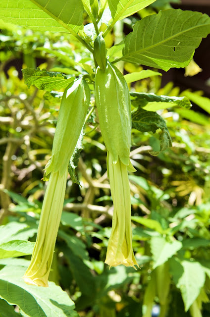
I can, however, distinctly remember the properties of the second thing - a little yellow flower whose petals he crushed and gave me to chew. A sharp taste then a complete numbing of my tongue and the insides of my mouth followed. ‘If you have a toothache, chewing this flower will deal with the pain completely’, he said and I was in no doubt of that claim!

There was a slight bitterness to the flavour but it was otherwise not unpleasant and I swallowed the flower - just as he said ‘You can spit it all out when the mouth is numb enough’
‘errrr….’
He laughed and said it’s OK to swallow it as well.
‘Phew!’


This flower, when chewed, makes your mouth, tongue and gums go numb.

The big group of uniformed young boys were still being talked to in a stern voice as we were discussing the wood and the flower. Just as we finished, they too were dismissed only to be equipped with brooms and brushes. It turns out these kids had all been caught in the nearby park playing truant from school. Rather than give them the usual school punishment, they were brought here to do work around the museum grounds and I watched as they broke into groups and began raking up dead leaves, scrubbing the rocks in the cascading rock pools, and sweeping up rubbish. The stern-voiced chap came over and explained this to me and I told him I thought this was a superb idea.

He also told me the museum will shortly be closed for repairs and renovations though no date had been set.

Resort on High

Leaving the museum, we drove on up the mountain and eventually got to the resort. Rather than a large single building, the resort comprises a number of single-storey structures, dotted around this very high plateau and set within well-tended and beautifully landscaped grounds. On one side is a magnificent view of the padi fields, other plantations and a few kampungs over 980 metres below us. Up here, despite the bright sunshine, the air was pretty cool and comfortable.

Some of the chalets are built on the side of the mountain and must have brilliant views. The resort also seems to have enough facilities to satisfy both the holidaying guest and one attending a seminar or retreat - there are a couple of meeting halls/rooms and a cafe within the resort as well.


Pulau Bunting in the distance


A Humungous Portion

Just outside of the resort is a little food court operated by a couple and their son. The food court was quiet and empty of patrons when we turned up but the wife told us they were open and took our orders. She then went to get her husband who was busy building up some new plant stands in a section of the garden. Looking around, we realised he seems to be quite a handy man and a creative one at that, repurposing various things as signboards and so on.

We were served our fried noodles and fried rice and were overwhelmed! These dishes are often fairly spartan affairs but what landed at our tables were humungous servings almost flowing over with toppings and ingredients - fried prawns, egg, fried tofu and more. Tasted pretty good too though both of us, fresh from gorging on chips and snacks in the car, had to leave some on our plates…


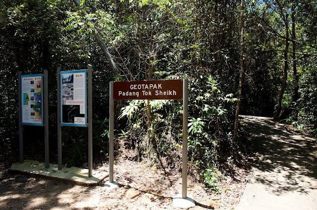
Further up from the food court is the Telaga Tok Sheikh. We drove in and here are a couple of picnic spots which I would avoid - garbage everywhere and signs of dereliction and disrepair. The Telaga itself seemed OK though we didn’t stop. Beyond it are a number of abandoned agriculture setups. We turned around and headed further up the mountain to Padang Tok Sheikh.

Abandoned though on our return trip we spotted some activity in the grounds.

Abandoned project near Telaga Tok Sheikh


A field of stone

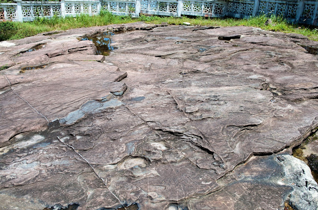
Not a field in the usual sense of the word, this area is instead a large rock face that is the oldest rock face in the peninsular - dating back 550 million years! This area was actually once the sea bed and continuous sedimentation caused it to be buried deep then compressed into rock. Some 220 million years ago, the entire sea bed was forced upwards into its current position some 1150 metres above sea level.

It is quite a wide area with fascinating patterns in the rock.


Lookout!

The telecoms towers are just a few hundred metres up the road but it’s narrow and you’ll have to reverse down again so it’s best to walk up form here if you wish to have a look.

But you don’t really have to as there’s a fantastic lookout point just to the right of the Padang. Go through to the right from the small minaret and you’ll come to a spot where you get a fantastic view of the surrounding environs. Much the same view as from the resort, but form an even higher elevation. A strange visual distortion caused by the shape of the coastline may cause you to feel the land beneath actually curves upwards in a surreal and mildly disconcerting manner. On the day we were there, there was a bit of haze in the sky so the shots are not too sharp. We could make out most details though and even spotted some birds of prey gliding high above the land.

This is a fantastic spot to have a picnic, I reckon, but we’d not packed any food and besides, were still stuffed from our lunch a little before. So we headed back down to the campsite instead.


A Campsite, the edge of a waterfall and a fatty river

This campsite was opened in 1988 and though there are signs of wear here and there, it seemed to be in generally OK condition. Not too much garbage about - something becoming all too rare nowadays, unfortunately. The paths were in pretty decent condition and though we walked past an abandoned orchid garden, the structure that contained it seemed to be used now as a storage place and wasn’t falling to bits unlike the structures at Telaga Tok Sheikh earlier.

Beyond this the area opened up and a few concrete structures were dotted about. On our right was a large concrete-walled pool in which a few guys were splashing about. The water looked decidedly murky though. Ahead of us, a river ran from the left and across to the right where it spilled over rocks then over a cliff edge. A set of concrete balustrades was built across the lip to prevent any mishap.

A couple of concrete bridges spanned this river though one was in a state of disrepair. The other was fine and we crossed then walked up the sodden bank to where a few benches and tables were placed.

The water in the river had the same dark red-brown colour of the pool and the surface was streaked with a filmy and foamy substance. I have seen this before and know it is not pollution but instead the lipid excretions of dead plants. Essentially these are the fats and oils from plants and they do give a yucky appearance but are not generally harmful.

The water in the pool was indeed from the river and flowed in endlessly and overflowed back into the river to spill over the edge of the waterfall, so the water, though looking dire, is actually fresh mountain water.


Someone had brought along a hammock and had strung it up in one of the concrete shelters - something I must do one day. Indeed I have a hammock in the car. It rolls up into a very bundle that fits in the hand and can easily be brought along in my backpack. I’ll do this one day…

Being a weekday, the place was deserted except for 4 or 5 guys and some workers cutting grass. I suspect it gets busier on weekends but there’s quite a lot of space so might still be comfortable.

Leaving Jerai, we descended back into the heat below. We’d spied an island connected to the mainland with a long and straight road bridge and wanted to find out more about this Pulau Bunting.


Unfortunately, we could not travel along the bridge as it was blocked off and in fact a couple of police cars were stationed there just then. The island didn’t look inhabited and might instead be a project in progress, or an abandoned one. We’ll find out one day.

We drove around Yan for awhile, watching tractor-ploughs working in the padi fields and checking out the small kampungs in the area we’d been looking at from 1200 metres up a little earlier. I think we’ll come back again when the padi is tall and the fields glisten gold in the sun. That’ll be something to see.


Sg Teroi Forestry Museum is at 5°48'20"N 100°26'6"E
Kem Rekreasi Gunung Jerai is at 5°48'22"N 100°25'57"E
Geotapak Padang Tok Sheikh is at 5°47'14"N 100°26'9"E

They called me John ‘Two-Hits-With-One-Stone’ Cheong

An old memory came to me today when Mei and I went cycling in Balik Pulau. After 2 months of being cooped up in our flat, it was great...